
Wall Works.
Millions of data points, synthesized into a single block of wood.
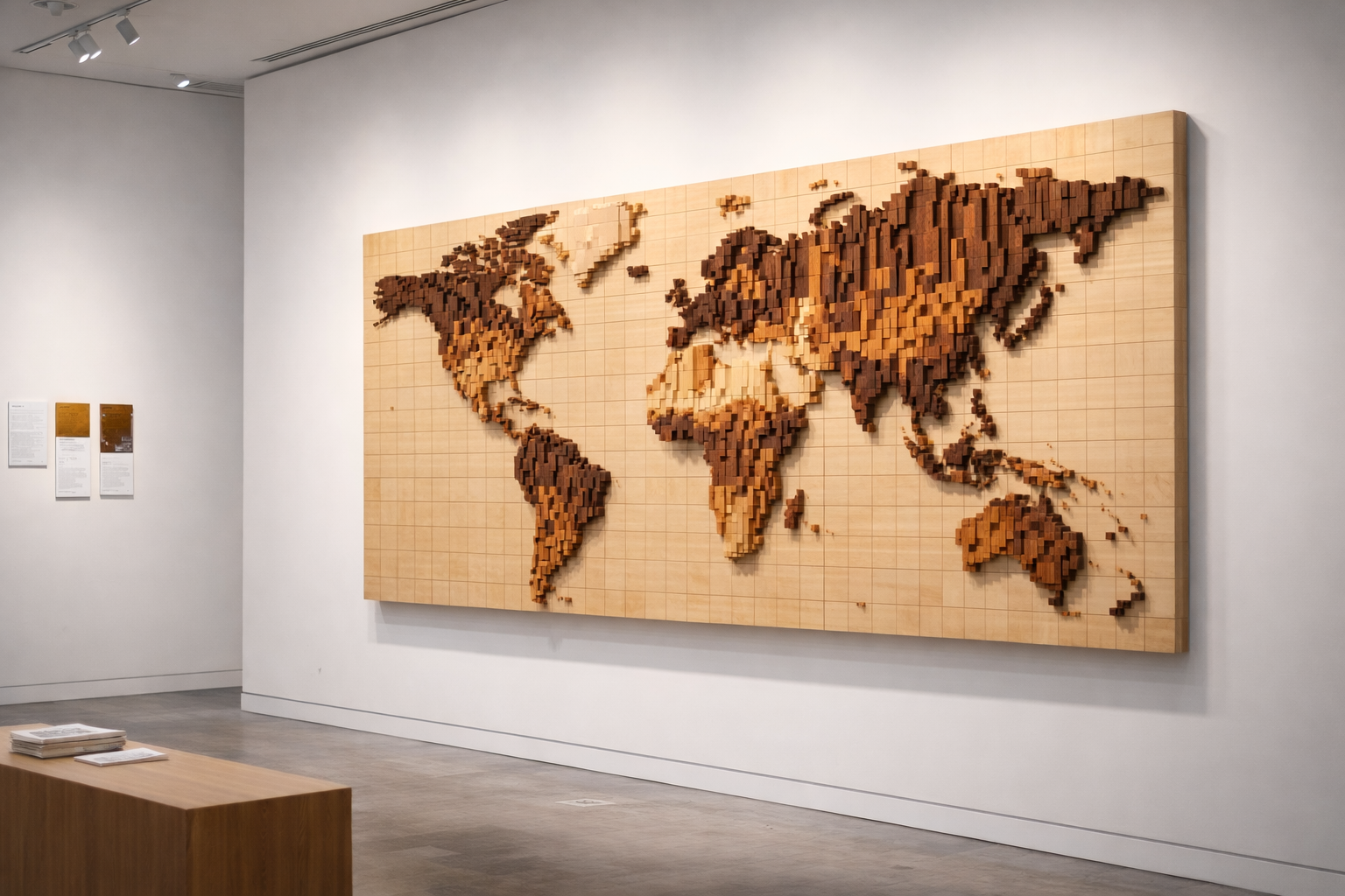
Each work in Relief Atlas: Earth, Rendered is shaped through disciplined analysis and precise woodcraft—balancing empirical rigor with material presence to translate complex systems into physical terrain. At Bark & Beam, our wall works are an exercise in calibrated elevation and material storytelling. This is where Data becomes surface.
While Relief Atlas anchors our studio practice, we also transform client-specific data—from institutional milestones to personal histories—into bespoke reliefs. If you have a narrative or dataset you wish to materialize, we welcome a conversation about a custom commission.
Relief Atlas: Earth, Rendered
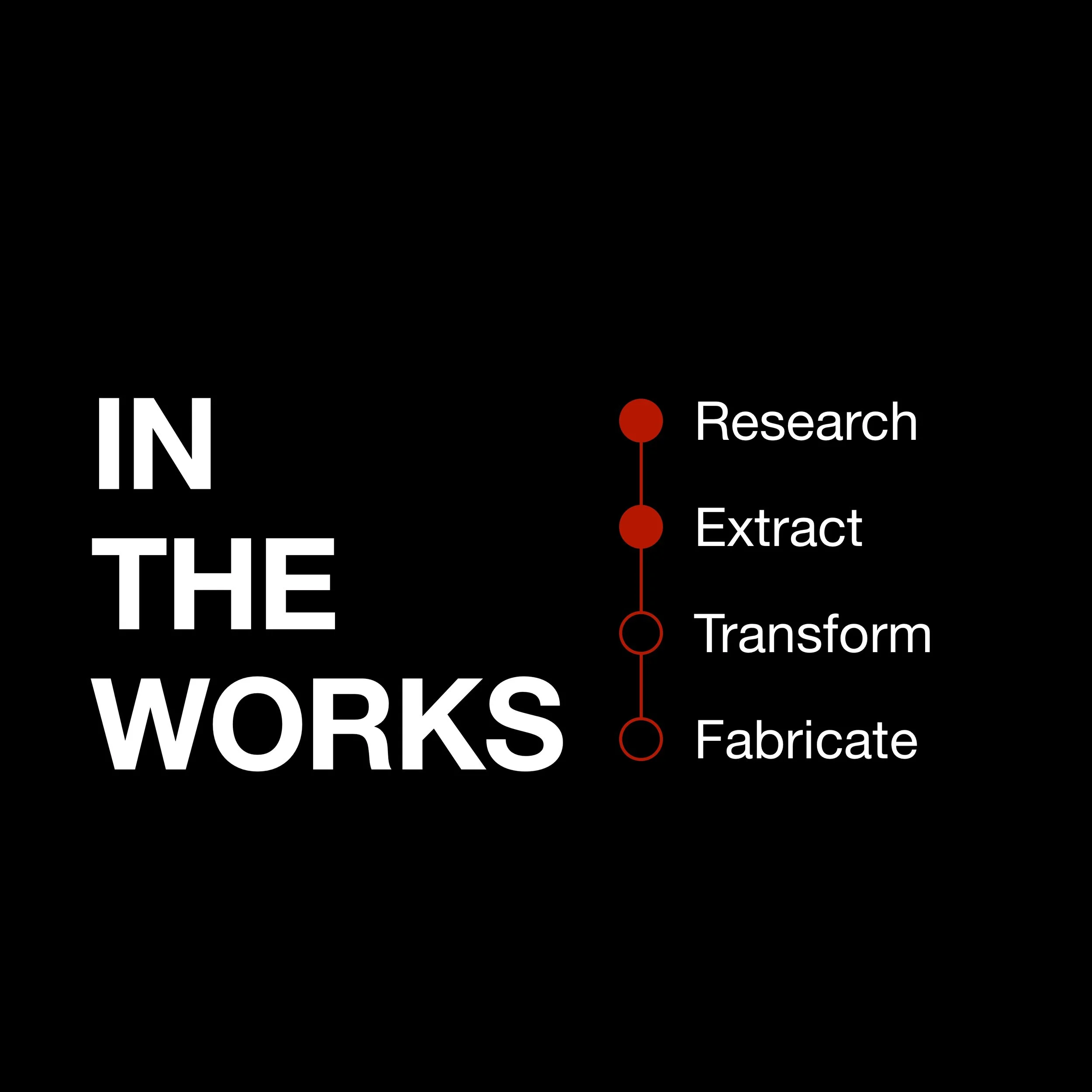


Relief Methodology
-
Research
Every work begins with a strategic question. We identify and vet global datasets that capture the true pulse of human activity—spanning 930 million population cells and 9.3 million economic data points. This stage is about finding the "topographic signal" within the noise.
-
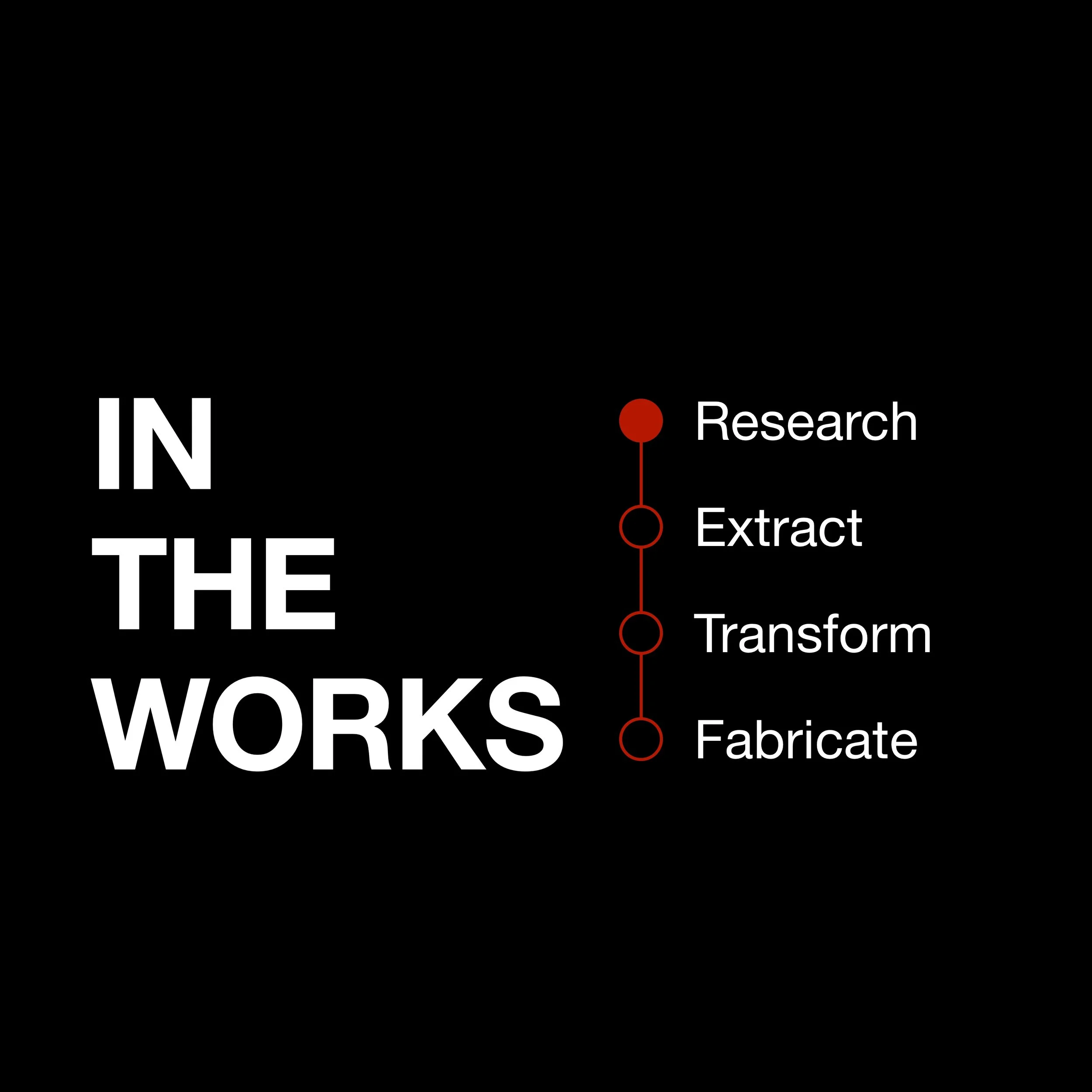
Extract
We bypass political abstractions like national borders to extract data at the most granular level—kilometer-scale resolution. By harvesting raw, gridded data, we preserve the authentic gradients of urban density and economic output that traditional maps obscure.
-
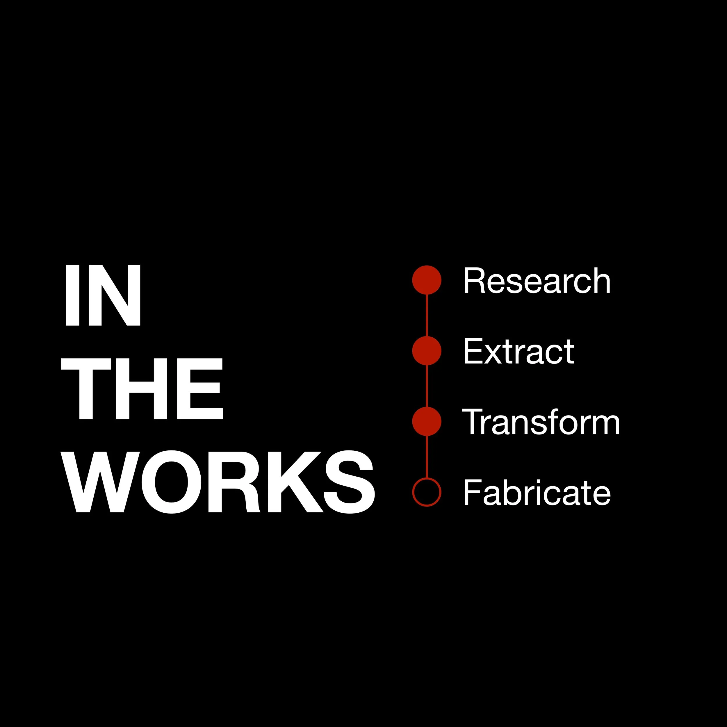
Transform
This is where data becomes geometry. Using the Equal Earth projection, we ensure geographic honesty across the globe. We then apply logarithmic scaling and rank-based binning to encode these complex values into a physical language: Maple, Cherry, and Walnut represent density, while 1", 2", and 3" reliefs represent magnitude.
-
Fabricate
The final "thousand judgments" happen in our Chicago studio. Each block is milled to a fixed footprint and hand-assembled onto a rigid backer. We use a concealed cleat system to ensure the final piece has an architectural, floating presence rather than hanging like a poster.
This relief reveals the physical imprint of humanity and economic activity across the planet. Peaks rise where population and productivity concentrate; vast plateaus and valleys mark regions of scarcity or dispersal. By translating density and output into elevation, the work transforms abstract statistics into a tactile landscape—inviting viewers to see the global economy not as numbers, but as terrain shaped by billions of decisions.